


17 panoramic photos of Soviet Donetsk 1973
- Michael Laxer
- Jun 21, 2021
- 3 min read

Known then as Yuzovka, Donetsk at the time of the revolution was a mining city with a population of just over 50,000. After the triumph of socialism the city (called Stalino in the 1930s) went through dramatic expansion and by 1941 was a much larger industrial city with a population of around 500,000.
As happened in places across the USSR due to the devastation of the war, by 1945 only 175,000 remained in a city that was largely destroyed.
The city rose again after the victory and by the time this folder of panoramic city views was issued in 1973 it had grown to just over 850,000 and was an important administrative, cultural, educational and industrial centre.
The images here consist primarily of streetscapes which are our favourite type as they really work to bring the time and place to life.
Shots of spots like the Monument to the Victims of Fascism, Lenin Ave., buses and a housing complex on Artem Street, the colourful railway station, the circus building and many others make this a real standout.
We have also included some information about the city and region taken from the one-volume encyclopedia of Soviet Ukraine that was published in 1969.
TEXT 1969:
Donetsk Region occupies the south-eastern part of the Ukraine. It borders on the Sea of Azov on the south. Area: 26,500 sq km; population (Jan. 1st, 1968): 4,909,000 (4,335,000 urban, 574,000 rural). The administrative seat is the city of Donetsk (855,000). Other big cities are Makiyivka, Zhdanov, Horlivka, Kostyantinivka. The Donetsk Ridge (altitude up to 350 m) and the Azov Heights run through the region. There are large deposits of coal (Donets Basin), rock salt, refractory clays and other minerals. The principal river is the Siversky Donets. The Siversky Donets-Donbas Canal is of great importance for water supply. The soils are mainly chernozems; the vegetation is of the steppe type.
The region is an important industrial district, possessing over 170 highly mechanized coal mines, big metallurgical and coke-and-chemical plants, heavy machinery works, building materials plants, high-capacity thermal stations, etc. In the central, industrial part of the region farming is of the suburban type (vegetable farms, dairy-meat cattle breeding); in the south, grain farming predominates. The region has the densest network of railways and motor highways in the Ukraine and the seaport of Zhdanov.
Functioning in the region are the Donetsk branch of the Academy of Sciences of the Ukrainian S.S.R. with research institutes, eight higher educational institutions, including Donetsk University, 79 special secondary schools. six museums and a planetarium. There are four state theatres in the region, one of them the opera house in Donetsk, and many amateur theatres and other arts organizations of workers.
There are branches of the unions of writers. journalists and artists of the Ukrainian S.S.R. Monuments have been erected in Donetsk Region to the revolutionary Artem (F. Sergeyev) in Artemovsk, to Taras Shevchenko in Donetsk, to the famous miner M. Mazai, executed by the Hitlerites in Zhdanov and others.

Donetsk Circus Building

Railway Station
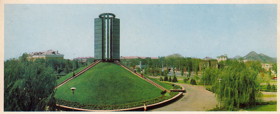
Monument to the Victims of Fascism

Artem Street

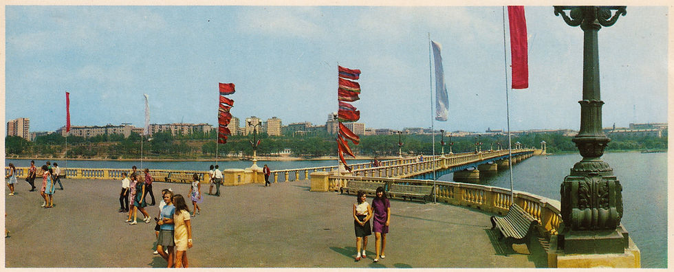
Lenin Avenue and the Kalmius Embankment

Building of the Regional Committee of the Ukrainian Communist Party and the Regional Soviet
Lenin Monument

The "Miner" Hotel and Conference Hall

Radyanska (Soviet) Square
Entrance to Shcherbakov Park

Institute of Traumatology and Orthopedics

Stadium of the Locomotive Sports Club

Apartment Houses on Lenin Avenue

Apartment Complex on Lenin Avenue
For a look at the remarkable story of Soviet housing construction see: A look at Soviet housing policy & philosophy, 1982 (theleftchapter.com)

By the Kalmius River

Shcherbakov Park

Building of the City Committee of the Ukrainian Communist Party and the City Soviet


Comments